Discover the world of catchment areas – geographic zones that shape where organizations attract customers or users. From business expansion and optimized sales to school district planning and healthcare service allocation, catchment areas are the key.
In this article, explore how businesses strategically position themselves, how institutions use catchment areas, and five mapping methods employed. Uncover tools like smappen for effortless catchment area creation and learn about GIS for precise calculations.
Join us in understanding catchment areas’ influence on markets and services, and how they drive informed decision-making.
What is a catchment area?
A catchment area is a geographic representation, usually on a map, of the area from which an organization can attract customers or users. Catchment areas are used by businesses, franchises, governments, institutions, and service providers.
How businesses use catchment areas
Businesses often use catchment areas for logistics, marketing, and sales strategy. Here’s how:
- Analyzing potential for a new location: With a catchment area, a business can use demographic and point of interest data to determine the best spot for a new store or franchise location.
- Managing sales territories: The last thing a business wants is to have its salespeople stepping on each other’s toes. Using catchment areas, each territory can be clearly defined.
- Running targeted local marketing strategies: By extracting population data from specific zip codes, marketers can optimize their strategy, ensuring they’re targeting the right area.
- Optimizing logistics: Through the use of isochrone maps, also known as travel time maps, businesses can set a delivery radius and manage service areas for technicians and similar roles.
When you are setting up a new company or opening a new point of sale, catchment areas are a crucial part of local market research, meaning they can reduce the risk of these investments. Franchisors, specifically, will use them for territory management and network development.
Catchment areas are just a starting point, though. Once they’re defined, they can be analyzed with demographic information, competitor research, and CRM data, which is generally provided by geomarketing platforms.
How schools and hospitals use catchment areas
Governments and similar institutions — from healthcare providers to school boards — use catchment areas to determine who can receive a particular service. In these fields, catchment areas are usually known as “catchment zones.”
A school board will use catchment areas to determine the schools that children in a specific zip code can attend. They might even create a map that reflects these areas to share with parents.
Other institutions, like hospitals and government offices, will use catchment areas to ensure that their services don’t overlap with each other too much. That way, they can place service centers in the most optimal places.
The 5 types of catchment areas
There’s more than one way to represent a catchment area on a map. Here are the five main methods:
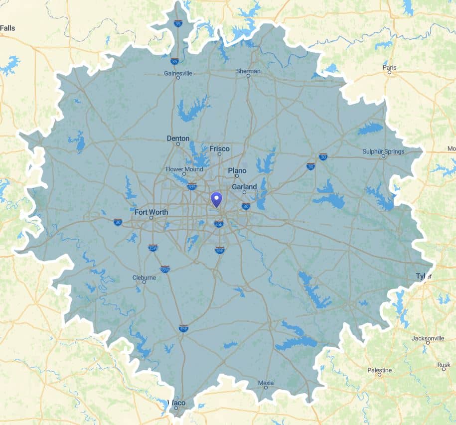
Isochrone map: This type of catchment area uses travel times and specific transportation methods to create a map.
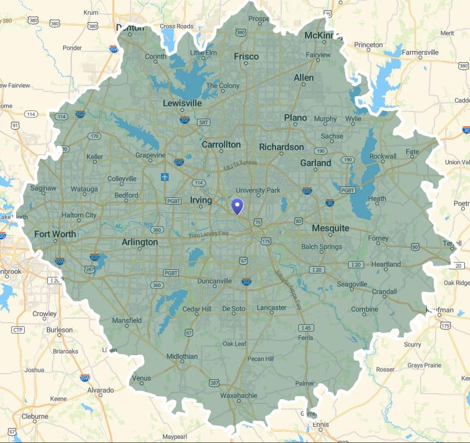
Isodistance map: This map uses a specific distance to create a catchment area.
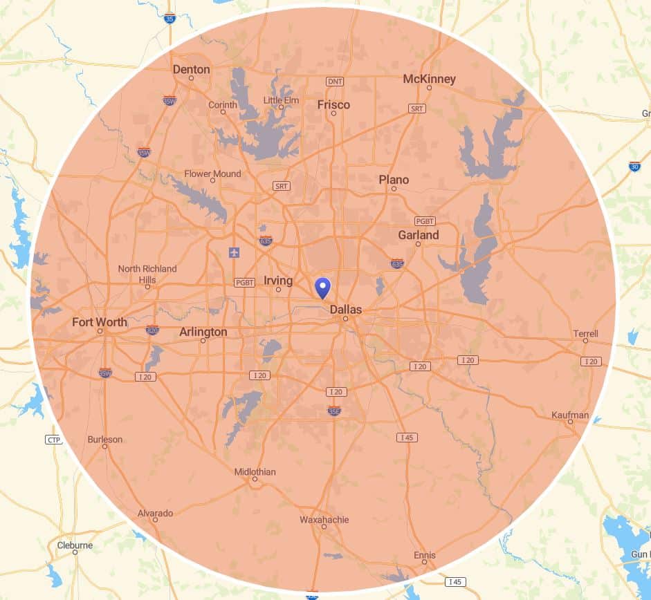
As the crow flies: This expression refers to the most direct path between two paths, ignoring physical boundaries, much like if a crow were to fly over them.
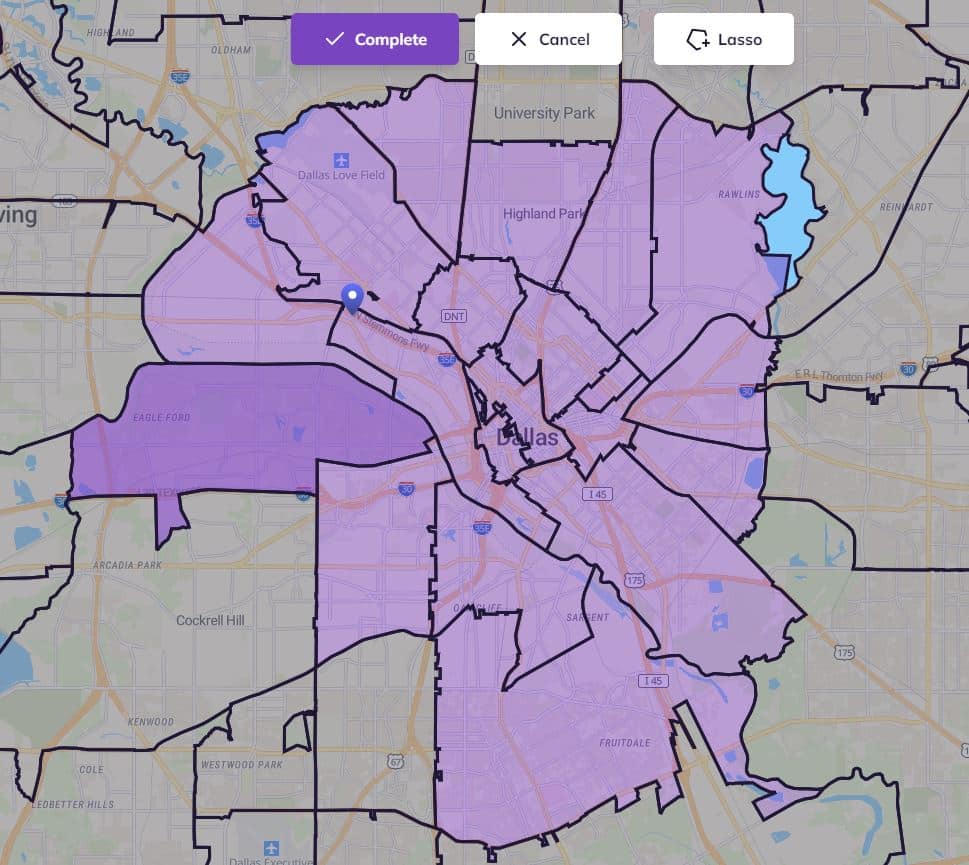
By administrative division: These maps use official boundaries to create catchment areas rather any measurement. Examples of these boundaries include zip codes, jurisdiction zones, and school districts.
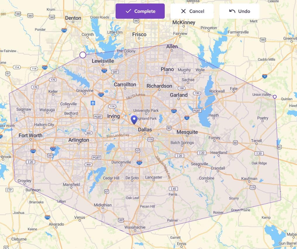
Manually: If none of these other types work, you can always draw your own catchment areas manually.
The isochrone is by far the most used and reliable approach. Indeed, an administrative division or a zone in distance cannot take into account the reality of the ground. For example, in mountainous regions, distances and travel time are not always correlated. In the same way, calculating a catchment area based on city borders cannot take into account customers who could come from another city that is only five minutes away from your location!
3 examples of catchment areas
Catchment areas are used by all kinds of businesses and institutions to represent the zones in which they can attract customers or users. Here are a few examples of how catchment areas can be used.
Franchise coverage
When a franchise is trying to decide where to open a new location, they’ll use catchment are to determine how big their potential market is and make sure there’s little to no overlap with other locations. They might use an isochrone map to represent this.
School districts
School boards are an example of an institution that uses catchment areas to determine who will receive services from a specific location. These catchment areas use administrative divisions rather than any other method.
Delivery range
Any business that delivers needs to factor in the cost of delivery into the price of what they’re selling. Whether they use isochrone or isodistance maps, these businesses use catchment areas to define how much they need to charge for delivery. Some may even decide that they won’t deliver at all beyond a certain zone.
How to start creating a catchment area
There are two steps to setting out a catchment area. First, you need to choose the right method. You could, for instance, use an isochrone map, which track travel times for a specific area. Alternatively, you can use an isodistance map — tracking travel distances — or even official boundaries, like zip codes and administrative zones.
Once you’ve picked your method, you’ll have to define the parameters used to measure your catchment area. For an isochrone map, that means setting a specific amount of time and a transportation method. For an isodistance map, you’ll need to set the unit of measurement and the distance.
Usually, catchment areas are created using isochrone maps. They usually represent a specific travel time through different transportation methods, from walking to public transport and cars.But isochrone maps can be drawn manually as radius, too.
Isochrones are the most-used method because of their accuracy on the ground. For example, zip codes can’t reflect the obstacles customers might face — for example, there could be a river or mountain, which they might struggle to get around.
The right choice of method and parameters will depend on multiple factors, such as your industry, the type of business you run, and customer behavior. To know which is best for you, conduct market research or at least survey prospects and customers. That way, you’ll get a better understanding of their habits and know where and how you can draw customers to your location. Don’t hesitate to use customer data you already have, too!
How do you calculate a catchment area?
You don’t need to calculate a catchment area yourself. You just need to find the right tool to do it for you. smappen offers an algorithm that automatically calculates catchment areas for you, based on specified parameters:
- Travel-time area: time in minutes and mode of transport
- Travel-distance area: distance in kilometers and mode of transport
You can also draw them on a map manually with a lasso tool. Start creating your area now.
How do you choose a catchment area tool?
Lots of mapping software packages offer the ability to draw catchment areas. It depends on what you need. With smappen, you can use a variety of methods to draw up to 10 areas on a map free of charge.
After that, you need to subscribe if you want access to all the features that enable you to take your analysis a step further: unlimited maps, unlimited areas, population data, importing data, automatic reports, etc.
How do you calculate catchment area using a GIS?
A geographic information system (or GIS) is a platform that integrates location data and descriptions with a map. This map can then be used to make better business decisions, perform market research, and more.
With a GIS like smappen, you can create catchment areas in multiple ways. All you need to do is start with an address, then decide whether you want to create a catchment area based on time, driving distance, manual inputs, or imported data. Want to see how it’s done? Check out our step-by-step guides:

