Optimizing your delivery operations might seem like a complex task, but with the right tool, it can become a breeze! Smappen’s radius map emerges as an innovative solution to effectively define and manage your delivery zones. By simply drawing a circle around a central point on a map, this tool allows you to visualize your coverage areas and make your strategies more efficient! We’ll tell you all about it in this article:
Use Radius to Map Delivery Zones
Ever wished you had a magical tool to make your delivery operations as smooth as butter? Enter the Radius Map, your new adventure companion in optimizing delivery zones! Imagine having the power to draw perfect circles on a map, effortlessly defining your delivery zones, and making your logistics team cheer in unison. If you’re tired of chaotic routes and late deliveries, it’s time to embrace the Radius Map and revolutionize the way you manage your delivery zones.
Let’s dive into the wonders of this nifty tool and see how it can make your life a whole lot easier.
Understanding Radius Maps
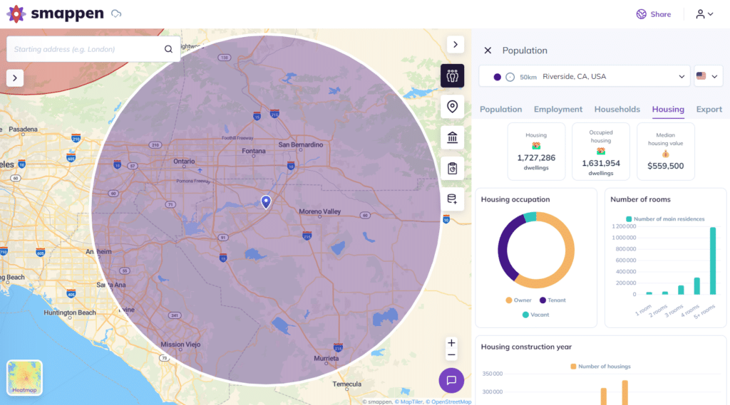
What is a radius map?
Understanding the dynamics of geographic data is crucial for any business, whether you’re running a local store, managing a franchise, or planning to expand. Two of the most valuable tools at your disposal are isochrone maps and radius maps. These tools help you visualize and analyze geographic areas, but they serve different purposes. In this article, we’ll dive deep into what each map type offers, how they differ, and how you can leverage them to grow your business.
Benefits of using radius maps for delivery zones
Implementing a Radius Map for your delivery zones comes with numerous benefits. Firstly, it helps in optimizing delivery routes. Clearly defining delivery zones allows you to plan the most efficient routes, reducing travel time and fuel costs. This not only saves money but also helps in reducing the environmental impact of your delivery operations.
Another significant benefit of using it is improved customer satisfaction. When delivery zones are well-defined and efficiently managed, it ensures that customers receive their orders on time. This can lead to higher customer retention rates and positive word-of-mouth, which are crucial for the growth of any company.
Moreover, a Radius Map can be a valuable tool for marketing and sales teams. By understanding the geographical distribution of your customer base, you can tailor marketing campaigns to target specific areas more effectively. This can lead to increased sales and better customer engagement.
Implementing Radius Maps in Your Business
How to create a radius map for delivery zones
Creating a Radius Map for your delivery zones is a straightforward process, thanks to the availability of various online tools and software. To get started, you need to select a central point, such as your warehouse or main office. From there, you can define the radius based on the distance you can cover within a specific time frame or budget.
Several tools, such as Smappen, Google Maps, MapBusinessOnline, and others, offer features to create Radius Maps easily. These tools allow you to input your central point, define the radius, and customize the map according to your business needs. Additionally, they provide options to save and share the maps with your team, ensuring everyone is on the same page.
It’s important to regularly update your Radius Map to reflect changes in your delivery capabilities and customer base. By keeping your map up-to-date, you can ensure that your delivery zones remain efficient and cost-effective.
Leveraging data from radius maps
A Radius Map is not just a tool for visualizing delivery zones, it can also be a valuable source of data for your business. By analyzing the data generated from your Radius Map, you can gain insights into your delivery operations and identify areas for improvement.
This data can help you make informed decisions about expanding or adjusting your delivery areas, investing in additional resources, or implementing new strategies to enhance your services.
Additionally, data from your Radius Map can be used to identify trends and patterns in customer behavior. This information can be valuable for your marketing and sales teams, helping them to develop targeted campaigns and promotions that resonate with your customers.
Need an example? Okay, let’s dive into it! Let’s consider a real estate use case. Imagine you’re a real estate agent who wants to target potential buyers within a specific distance from a new property listing. By creating a Radius Map centered on the property’s location, you can define a radius that covers areas of interest.
With this map, you can identify neighborhoods within the radius and focus your marketing efforts on these areas. This targeted approach ensures that your promotional materials reach the right audience, increasing the chances of attracting interested buyers. Furthermore, you can analyze the data to understand which areas generate the most interest and tailor your strategies accordingly.
Using a Radius Map for delivery zones is a powerful strategy that can help businesses optimize their delivery operations, reduce costs, and improve customer satisfaction.
Here is a Customer Story from The Great American Home Store 🚀
By understanding and implementing Radius Maps, businesses can ensure that their delivery processes are efficient and effective, leading to better service and increased profitability.
Whether you’re a small business looking to streamline your local deliveries or a large enterprise aiming to expand your delivery network, a Radius Map is an essential tool that can help you achieve your goals. Start using a Radius Map today and experience the benefits of optimized delivery zones for your business.