Running a successful franchise can be complex. As a franchisor or retailer, you need to balance managing a bunch of different locations. That means anything that can make your life easier is a huge asset. Finding an easy way to map your trade areas can streamline your business strategy and even help with recruiting new franchisees or opening new stores.
Here’s how it’s done.
How to calculate your trade areas
There’s more than one way to map out a catchment areas, and it all boils down to how you want to measure things. Specifically, you can calculate your areas in one of five ways.
Isochrone maps
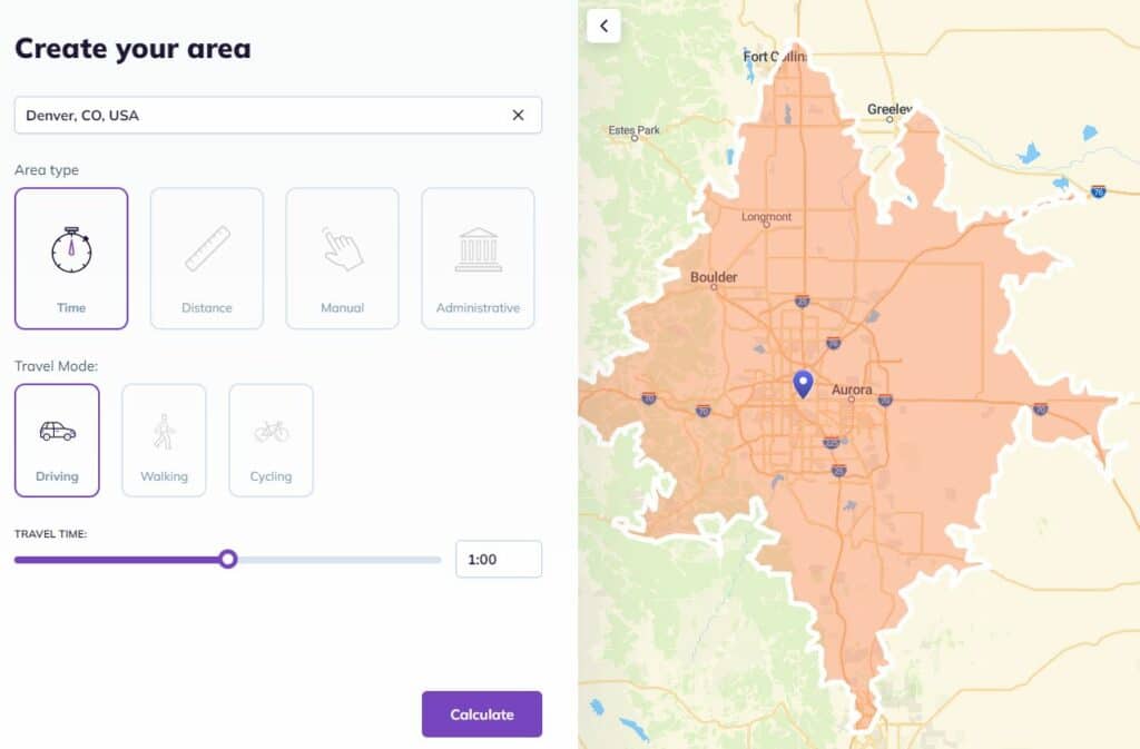
When drawing an isochrone map, you pick a travel time (like half an hour) and a means of transportation (like driving) and use that to measure out your map. The biggest advantage of this method is it gives you a map that accurately communicates real-world conditions. That means it’s closer to representing actual customer behavior than some other methods. Depending on the industry you’re in, switching between transportation methods and creating more maps can give you even more information about your ideal customer.
Isodistance maps
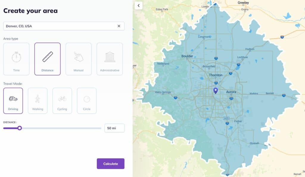
An isodistance map is similar to an isochrone map in that it represents real-world conditions — only with distance instead of time. All you need to do is pick a specific distance and map that out over existing roads (if you’re targeting people who usually drive) or public transit routes (if you’re targeting people who use public transit).
As the crow flies
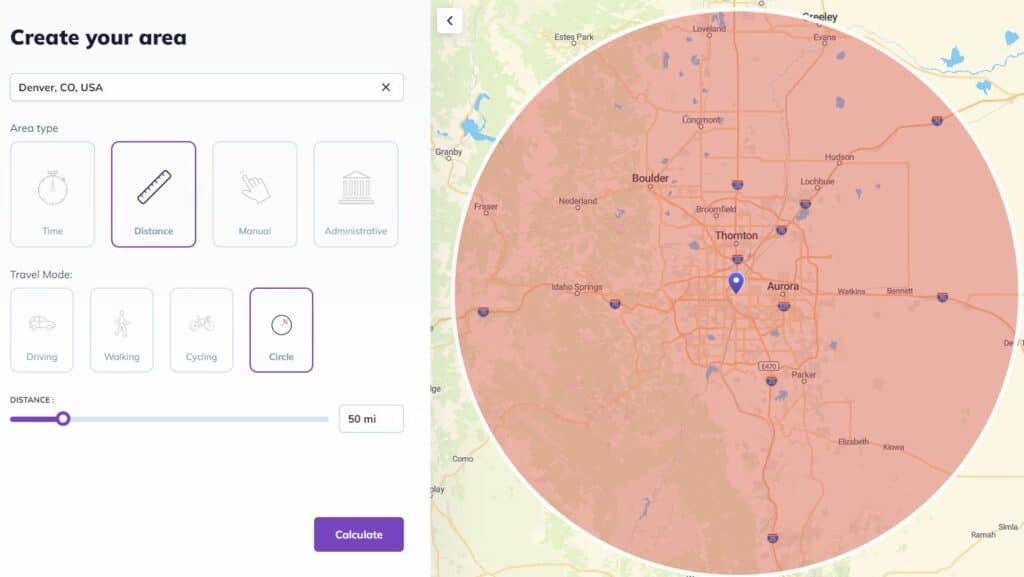
The term “as the crow flies” is pretty old, with one of the earliest uses coming from the Charles Dickens novel Oliver Twist, published back in 1838. It essentially means the same thing as “in a beeline,” referring to the straightest line between two points. While drawing a territory with this method isn’t necessarily the most accurate, it’s definitely one of the simplest.
Administrative boundaries
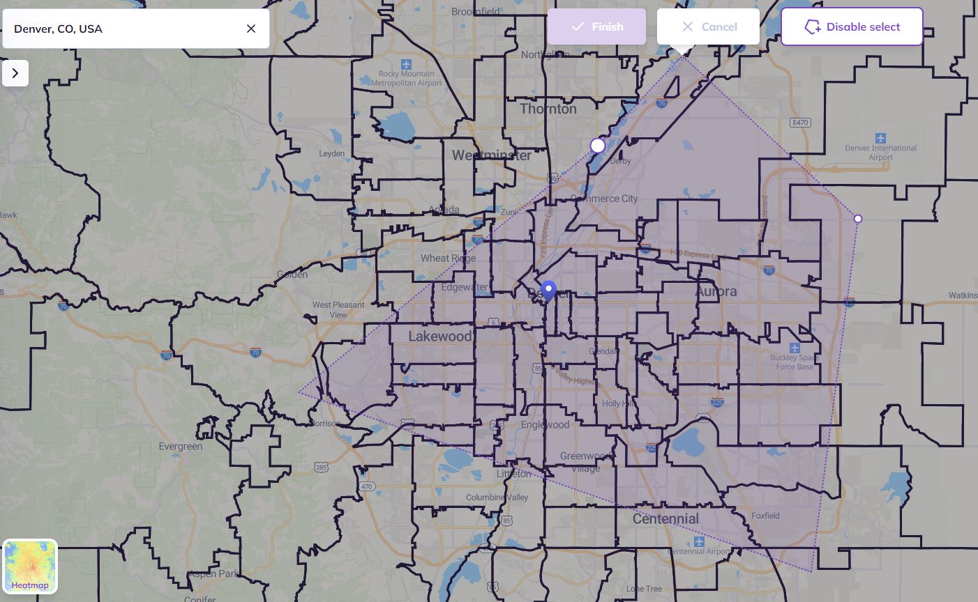
For some industries, each stores’ customer base will have more to do with administrative boundaries — like county lines, zip codes, or school districts — than distance or time. If that’s the case for you, then you’ll need a map of these boundaries to properly draw out your territories.
>> Tutorial: How to create an area with administrative boundaries (zip codes, counties, states)
Manually
Whether you’re working off of your own customer data or have your own proprietary method of drawing territories, sometimes you just have to do things the old-fashioned way. You don’t necessarily need to break out pen and paper to use this method, though. A location intelligence tool like Smappen can help you draw manual trade area without a ton of work.
How to break down your territory
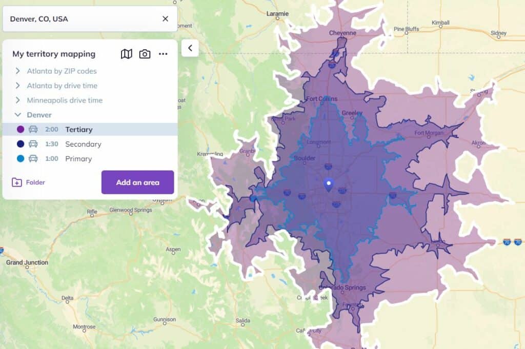
Now that you know which methods you can use to map out your trade area, here’s an important aspect you need to remember: how to break down your territories. That’s because, like many things, territories benefit from a bit of nuance. So when mapping out territories, remember to break them up into primary, secondary, tertiary, and outer territories.
Primary territory
Your primary territory will include the vast majority of your customers — as much as 80% of them. Depending on your industry and how you map your territory, this area could cover just a few miles or a half-hour drive.
Secondary territory
This part of your territory will represent fewer customers, but your brand will still have a strong presence here. That said, this is where competition from other businesses can pull a lot of your potential customer base away. This can either be because they’re in a better location than you or their marketing campaigns are more effective.
Tertiary territory
A franchise’s tertiary territory represents an area where it has very few customers. You likely won’t be focusing marketing or sales resources in this territory, but it’s good to use it as an outside boundary for a store’s reach.
Outer territory
The outer territory is the area where you don’t really have any presence. You might get a handful who make the trip every once in a while, but not any kind of repeating business you can really rely on. Note that one store’s outer territory could very well be within the primary territory of another, which would mean you’ve situated your locations properly.
By breaking down each level of a territory, franchisees can have a better idea of where their customers are coming from — which can help guide local marketing initiatives. For franchisors, doing this limits cannibalization between multiple locations.
3 tips for getting the most out of your territories
You’ve mapped your territories, but it doesn’t stop there! Having a nice, accurate map is a great asset for a ton of initiatives, from marketing campaigns to recruiting new franchisees.
Use location intelligence to your advantage
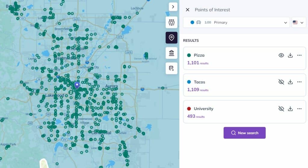
Customer data is a great way to map out your territories, but location intelligence is how you make the most of them. With a location intelligence tool like Smappen you get access to all sorts of data you can use for this, from U.S. census data to postal codes and more.
Map your competition’s territories
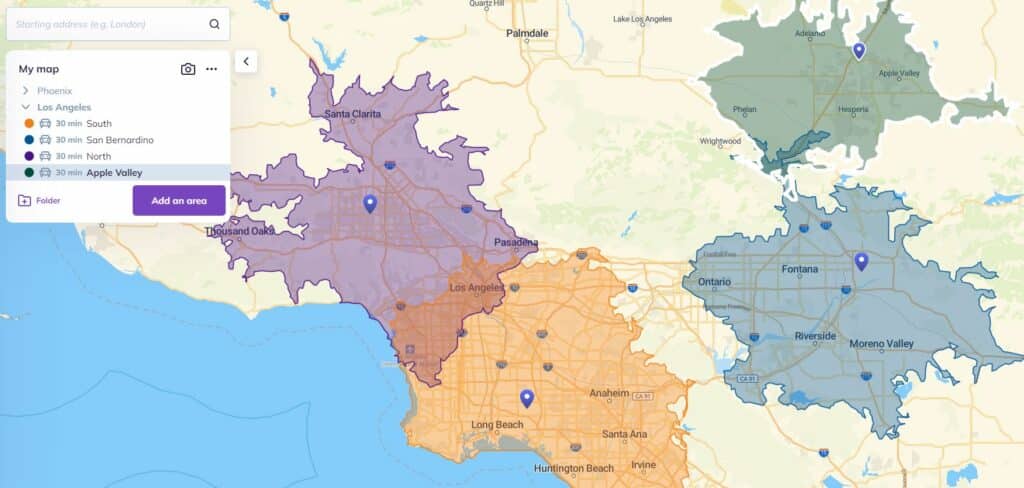
Having a better idea of where your stores’ customers are coming from is one thing, but imagine if you could analyze the competition in the same way. While you might not have their customer data, you can still get a general idea of the territories they’re operating in. That can be incredibly valuable when looking for ways to out-compete them.
Create easily shareable maps for potential franchisees
Mapping out your territories isn’t just great for analyzing a current location’s performance; it’s perfect for recruitment, too. With an easily-shareable map — made with a tool like Smappen — you can give them a visual representation of how their potential business is going to run.
Check the map
Territory maps help retailers and franchisors run a more efficient business and franchisors streamline the overall business’ strategy. Just pick a method that makes sense for your industry, map things out, and use data to get into the nitty-gritty of your customer base.
Want a tool that does (most of) the work for you? Try Smappen for free!

