Managing shipping zones and setting fair shipping costs can be a bit overwhelming, especially as your business grows. But it doesn’t have to be complicated. With Smappen, you can easily visualize your delivery areas, adjust your shipping rates, and make sure you’re charging customers fairly based on their location. Here’s a guide on how to do that, with a focus on how Smappen can make the whole process smoother for you.
TL;DR
To optimize shipping zones and costs, create zones based on distance or location (like zip codes), and apply specific rates to each zone. Export customer data to refine zones and add additional fees like weight-based charges. Use Smappen to simplify the process, visualize customer locations, and automate rate applications to save time and reduce errors.
Getting started with shipping zones
The first step to creating shipping zones is figuring out how you want to divide your areas. Maybe it’s based on distance from your warehouse, or perhaps by specific regions like zip codes or cities.
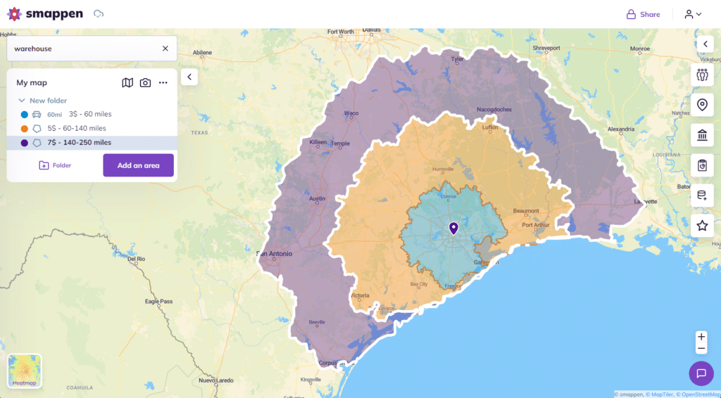
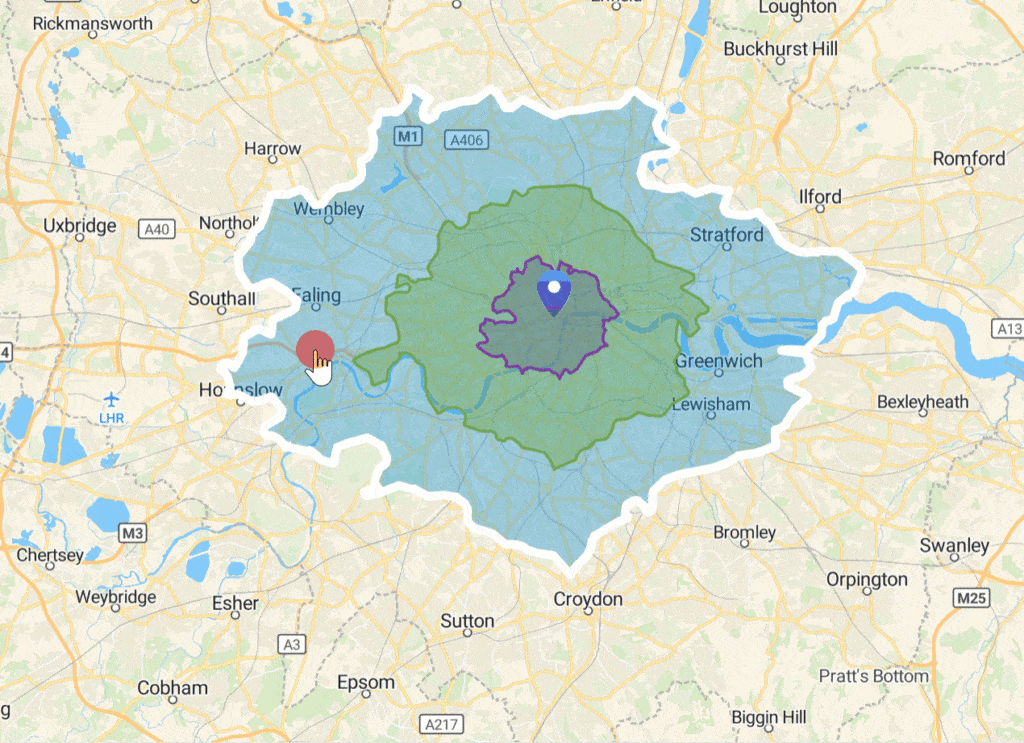
With Smappen, you can draw these zones on a map, allowing you to see exactly where each zone begins and ends. This visual aspect is a huge advantage because it takes away the guesswork and gives you a clear picture of how far your deliveries are reaching.
Once you’ve created these zones, you can assign shipping rates to each one. For example, you might charge $3 for deliveries within 60 miles of your warehouse, $5 for areas between 60 and 140 miles, and $7 for anything further out.

Smappen allows you to customize these zones to suit your specific needs, so you’re not just limited to distance—you can even define zones by delivery time or other factors if that makes more sense for your business.
You can also apply it to your technicians’ intervention zones!
Once you have created your zones, don’t forget to subtract them from each other to only consider the outer ring of each zone. This way, you can accurately analyze the specific content (corresponding zip codes, population data, number of customers, etc.).

Why using territory mapping for managing shipping zones
One of the best things about using a territory mapping software like Smappen is how easy it makes managing your shipping zones. You’re not just creating areas blindly; you can actually see on the map how these zones interact with the real world. This means you can adjust your zones based on real customer data, rather than just assuming how far you’ll need to deliver.
For example, if you notice that a lot of your customers live in a particular area that’s right on the edge of two zones, you can easily shift your zone boundaries in Smappen. This kind of flexibility is crucial, especially if your business is growing or if you’re expanding into new areas. Smappen makes it easy to go in and make adjustments as needed, so you’re always charging the right amount for shipping based on real data.
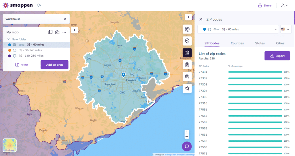
Another way Smappen helps is by allowing you to export data. Once your zones are set, you can export a list of the zip codes or areas that fall within each zone. This makes it really easy to integrate that information into your existing systems, so you don’t have to manually look up shipping rates every time a customer places an order. With just a few clicks, you’ll know exactly how much to charge based on their address.

Optimizing shipping zones over time
Smappen isn’t just about creating zones once and forgetting about them. As your business grows and your customer base changes, you’ll want to revisit your shipping zones to make sure they’re still working for you. This is where importing customer data into Smappen becomes incredibly useful.
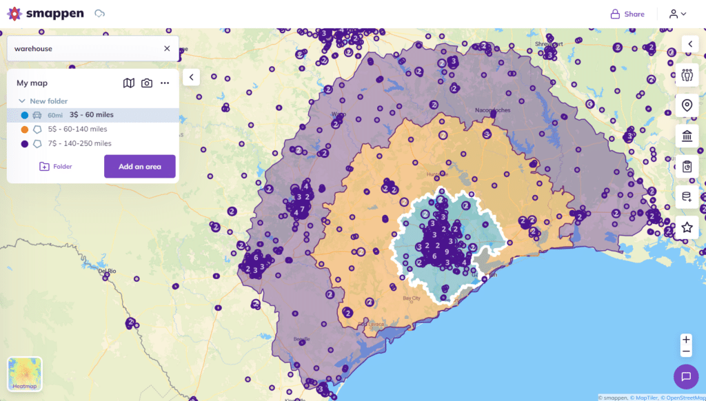
By importing your customer data, you can see where your orders are coming from and adjust your shipping zones accordingly. If you notice that one of your zones has very few customers, you might decide to shrink or remove that zone altogether. On the other hand, if you’re getting a lot of orders from a particular area, you might want to expand that zone or offer a more competitive shipping rate to encourage even more orders.
Smappen also allows you to visualize your customers on the map. You can pinpoint their exact addresses and see how they fit into your existing zones. This not only helps with optimizing your zones, but it also gives you a deeper understanding of where your customers are located and how you can better serve them.

Managing extra charges like weight-based shipping
In some cases, you might need to add extra charges on top of your base shipping rates—like a fee for heavier packages. Smappen makes this process seamless as well. You can import your order data, including details like the weight of each package, and then calculate any additional fees right within the tool.
For example, if a customer’s order is located within a certain zone, you can see their shipping rate, and if there’s a weight-based charge, you can easily add that in. This saves time and helps you avoid making manual calculations, which can often lead to mistakes. With Smappen, everything is laid out in front of you, so you can see exactly what each customer should be charged.
Making shipping easier with Smappen
One of the main advantages of Smappen is how much time it saves you. Instead of manually figuring out shipping rates for each order, Smappen gives you all the tools you need to automate the process. You can quickly create zones, adjust them based on real data, and ensure that your shipping rates are fair for both you and your customers.
If you haven’t already, try out Smappen’s features to streamline your shipping process, reduce errors, and ultimately provide better service to your customers. Whether you’re just starting out or you’re managing a growing business, Smappen can make a big difference in how you handle shipping zones and costs.
FAQs
Shipping zones are geographic areas that are segmented based on specific criteria like distance or zip codes. Different shipping rates are applied to each zone based on the cost to ship to that area. You can also apply it to your technicians’ intervention zones!
Rates are typically based on factors like distance from your shipping location, shipping time, or order weight. Start by segmenting areas (e.g., 0-12 miles, 12-18 miles, etc.) and assign a rate to each.
Yes! By importing customer data regularly, you can refine your shipping zones to match real-world demand. If a zone has few customers, you might adjust its size or rates. Smappen is very flexible and allows you to adjust zones as your business grows or your customer base changes.
Once your zones are set, Smappen allows you to export lists of zip codes or regions that fall within each zone. This makes it easy to integrate your zone data with your existing systems, so you can automate shipping costs for each order.
Smappen allows you to visually create and adjust shipping zones on a map, so you can see exactly where each zone starts and ends. It also lets you export and import customer data, making it easier to manage and refine your zones over time.

